Smart Laser Measurement Solution

More Details

“Site Survey and Estimation tool at your finger tips”

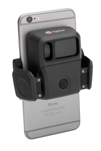
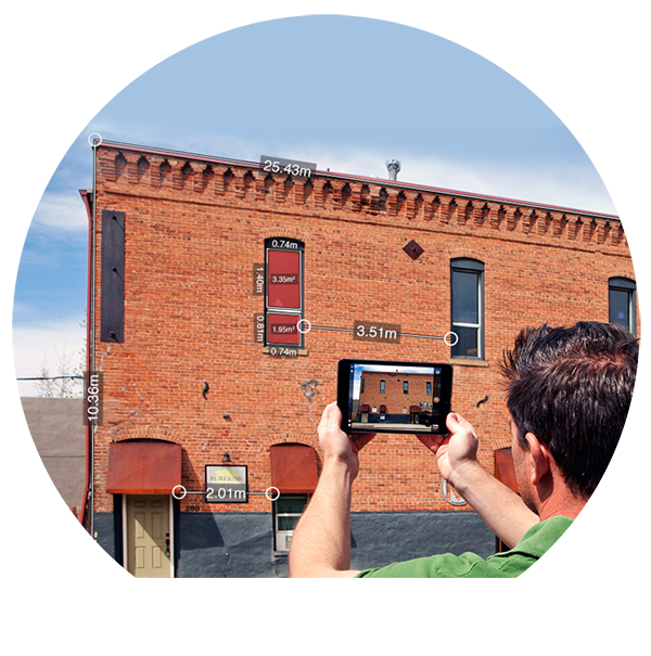
Spike is a smart laser measurement solution for all types of geospatial applications. With Spike, you can quickly measure the width, height and area of objects, such as buildings or other assets, simply by taking a photo from your smartphone or tablet. In addition, you can measure the distance between two points and quickly and safely capture a target’s location, your location, and a georeferenced image of the target. Data collected with Spike can be imported into GIS software including Collector for ArcGIS® and Survey123 for ArcGIS®. The Spike device and Spike mobile app transform your smartphone or tablet into a comprehensive geospatial measurement solution.

Key Features & Fuctionality

  • Photo Measure: real-time measurements from a photo
  • Point-to-Point: measure the distance between two objects
  • Measure Remote Objects and Collect GPS/GNSS Location From A Distance
  • Measure and Share Using the Spike Cloud
  • Export and share captured photos and measurements
  • More Details

    Specifications

    Device and OS
  • Spike works with commercial Google Android and Apple iOS Smartphones and Tablets. To view a list of recommended devices that have gone through camera calibration procedure and provide the highest level of accuracy, visit the Spike Support Center.
  • Connectivity
  • The Spike device connects with your Smartphone or Tablet via Bluetooth. Your device must support BLUETOOTH 4.0 low energy technology.
  • Battery
  • The Spike device has an Internal Li-ion battery that is charged via a micro USB charging port (a USB cable is included in the box with Spike). Battery life is 4 hours of continuous use.
  • Laser
  • Spike’s eye safe laser rangefinder supports ranges between 6-650 feet (2-200 meters). The accuracy of Spike’s laser rangefinder is ± 5cm (2 in).
  • Accuracy
  • The accuracy of Spike’s laser rangefinder is ± 5cm (2in); the accuracy of Photo Measurements is ± 1%; and the accuracy of Point-to-Point Measurements is ± 3%. For additional information on optimal distances and positions, visit the Spike Support Center.
  • Units
  • Spike supports measurements in feet + inches, inches, meters, or centimeters. Unit settings may be changed at any time via the Spike app settings or Cloud settings.
  • Output Formats
  • Measurements are stored with the photo and can be shared as a PDF, JPG, Spike File (XML), or KMZ. For Android devices only, additional output includes HMTL. The Spike File is a compressed .ZIP file, which contains the Spike photos and XML file with measurement and location data.
  •  


    For more details please visit www.ikegps.com/spike